
ROLE
Design Intern
TIMELINE
Jul 2022- Aug 2022
(8 weeks)
SUMMARY
Selected as Best Prototype and Best Pitch out of 10 other design teams.
OVERVIEW
How might we redesign Google applications to help communities recover from the impacts of the COVID-19 Pandemic?
Our team explored how communities, especially small business owners and local residents, struggled with connection, visibility, and economic recovery. We focused on Google Maps as a platform to rebuild community engagement, helping users discover and support local, POC-owned businesses affected by the pandemic.
PROBLEM
Google Maps helps people find places, but not build ongoing relationships with local businesses.
As more people discover and choose local businesses through Google Maps, the experience is still optimized for one-off decisions—ratings, directions, basic info—rather than ongoing relationships. Merchants have limited ways inside Maps to share updates, highlight what makes them special, or stay in touch with customers after a visit. This gap reduces meaningful engagement for users and missed opportunities for small businesses.
Project Limitations
⏱️ Short Timeline
We only had a few weeks to conceptualize, ideate, and refine our design so user research was limited.
Prototype Only Validation
The work stayed at the prototype stage so we weren’t able to run live experiments or track real usage metrics
SECONDARY RESEARCH
99.8% of New York businesses are small businesses and they employ 49.1% of all New York employees ... but 77% reported revenue decreases in 2021
We conducted secondary research to understand the severity of the economic effects of COVID-19 on small businesses—especially in the aftermath of COVID-19. Many were still facing closures, particularly among Black-, Latinx-, and Asian-owned businesses.
34% of America’s small businesses are still closed due to COVID-19
⬇️ African-American businesses faced a staggering 41% drop.
⬇️ Latinx business activity fell by 32%
⬇️ Asian business activity dropped by 26%.
USER RESEARCH
Storytime: Beatrix and the Laundromat
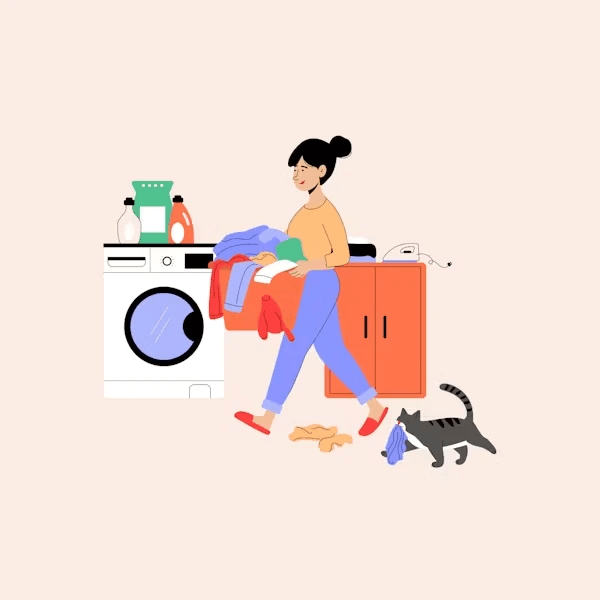
We listened to a story from Beatrix, a New Yorker who realized that her neighborhood laundromat, one she’d used for years, had almost no online presence.
After the pandemic, the business was struggling to bring customers back because it lacked the visibility and digital tools larger companies had.
This story illustrated a common issue for small, POC-owned businesses: they existed in the community but were invisible online.
FEEDBACK
Google mentor feedback validated our concept
Our Google mentors affirmed that our problem space was relevant and well-developed, encouraging us to narrow the scope, sharpen who our primary user was, and make our concept feel “native” to Google Maps. Their feedback pushed us to simplify the entry point, reduce UI complexity, and clearly articulate how “Connection Mode” would add value without overwhelming merchants or users.
USER RESEARCH
We identified who would benefit from this feature
We discussed this ongoing idea with our mentors and brainstormed who our key users would be, then developed personas to represent potential beneficiaries, summarized below.
👩🏽🍳 Small Business Owner
Goal: Gain visibility and connect with broader audiences.
Many are immigrant small-business owners looking for ways to promote their shops and rebuild their local presence.
🧍🏽♀️ Local Resident
Goal: Support and discover neighborhood businesses.
Residents want affordable, convenient options close to them that are easy to visit and return to.
✈️ Tourists
Goal: Find authentic, shareable local experiences.
Visitors want to try diverse cuisines and get a feel for local culture through community-driven recommendations.
🏛️ Cultural Organizations
Goal: Uplift local communities and promote awareness.
Nonprofits and cultural groups want to spotlight under-represented businesses and strengthen community ties.
DESIGN PROCESS
We quickly moved into Figma to bring our ideas to life
With a short project timeline, we starting building our design in Figma. Our team collaborated in a shared design file, combining sketches and concepts into cohesive screens while continuously refining them to align with Google Maps’ design system and visual language.
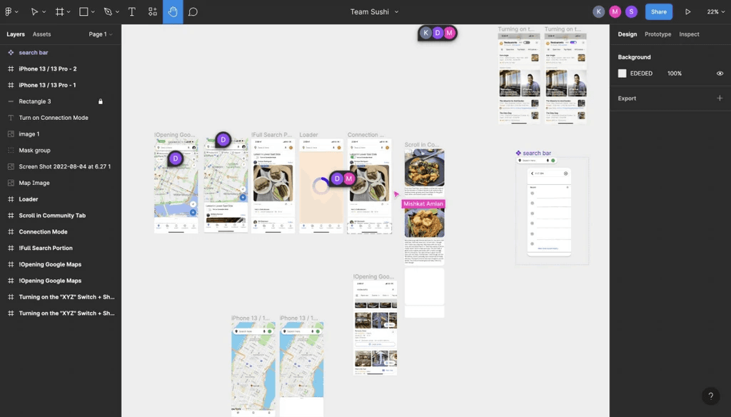
Wireframes & Flows
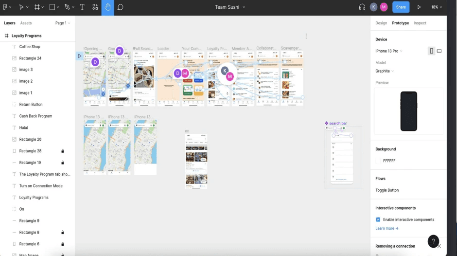
Refining & Prototyping
FINAL DESIGN
Final Screens & Features
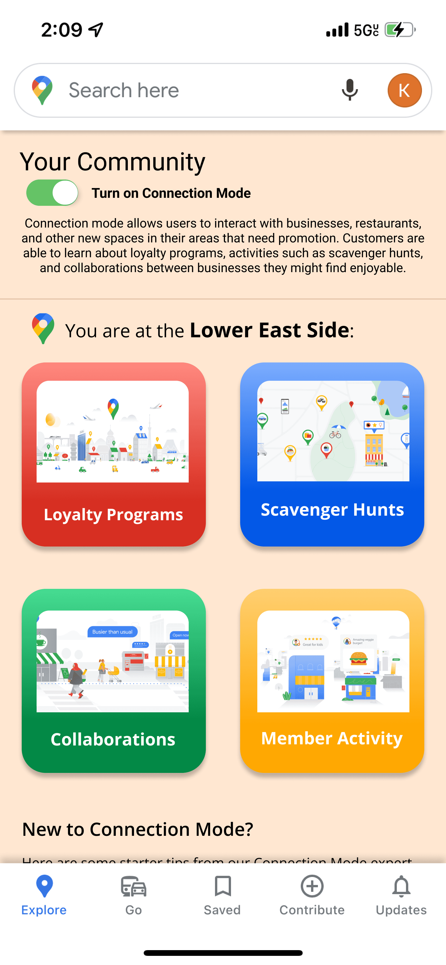
Your Community
The main hub where users enter Connection Mode.
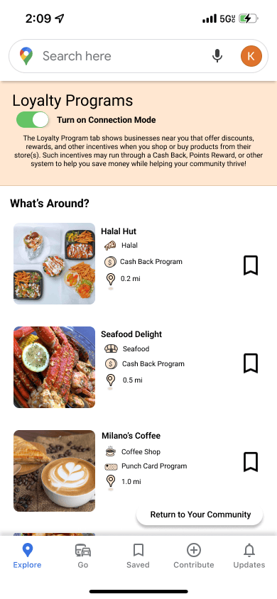
Loyalty Programs
Users can track stamps, points, and rewards from the businesses they follow.
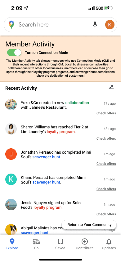
Member Activity
A feed of recent visits, check-ins, redemptions, and collaborations that helps users engage with the community.
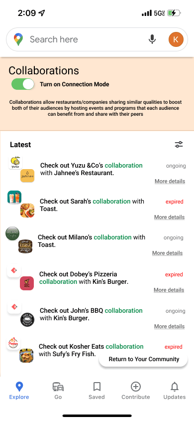
Collaborations
Users are encouraged to discover new places through partnerships, cross-promotions and joint events between local businesses.
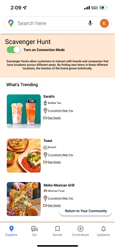
Scavenger Hunt
Curated challenges that guide users to explore new businesses, complete location-based tasks, and unlock rewards around the city.
Features
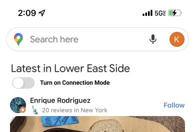
Easy Toggle
Users can switch Connection Mode on or off directly from the Maps home screen, making it feel seamless and optional.
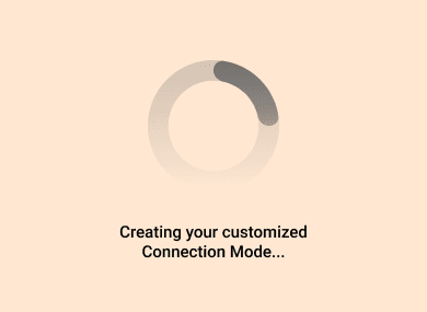
Loader
A brief loading state shows Connection Mode being personalized for their area, clarifying what’s happening while they wait.
REFLECTION
MDOS X UMSI Project Takeaways
I learned a lot working on this project alongside my team and mentors. Though the quick timeline forced us to balance big ideas with practical execution, it also made moving forward with design a quicker process since we had less time for decisions. I also found it really helpful to bounce ideas off our Google mentors and hear their feedback—they provided perspective on what could work, what might need refinement, and what should be saved for later. They also offered valuable insight into how to align our designs with Google’s ecosystem. Our team was awarded Best Prototype at the end of the sprint, which was incredibly rewarding and validating to see our design efforts recognized. 🏆
📍 Designing Platform-Native Experiences
I learned how to design something new without breaking what already works. I spent a lot of time thinking about how Connection Mode could live inside Google Maps without feeling like a separate app. That meant using familiar patterns, aligning with existing entry points, and shaping the UI so it felt like a natural extension of Maps.
🎯 Tight Deadlines
Through this project, I really felt what it means to design under pressure. Our team of 4 was getting feedback constantly, and I had to quickly absorb it, steer us back to the core experience, and decide the key features we could build well under time constraints.